Thursday, January 31, 2013

Presidential Visits to Antietam

Presidential Visits to Antietam National Battlefield by John David Hoptak

President Lincoln Meets With General McClellan on the Antietam Battlefield
* * * * * * * * * *
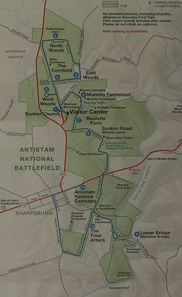
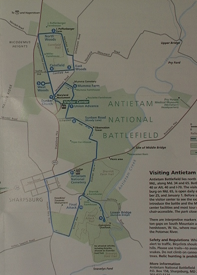
There is a strong presidential connection to the Antietam Battlefield. . .In addition to future president William McKinley serving as a commissary sergeant in the 23rd Ohio during the battle itself, no less than eight sitting presidents have visited the Antietam battlefield.
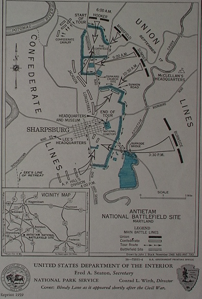
The first, of course, was Abraham Lincoln, who spent four days travelling over the field in early October 1862, just two weeks after the guns fell silent. He met with McClellan, trying to prod his young Napoleon into action, met with other generals, and with thousands of wounded soldiers. . .both Union and Confederate. His trip was well-documented, and the photos of his visit are among the most famous of the entire war. Oh, and who can forget the 26-minute long film, "Antietam Visit," which details Lincoln's famous visit and shows on the half hour at the Antietam National Battlefield's Visitor Center?

Lincoln with McClellan. . . and George Morell, Fitz Porter, Henry Hunt, Jonathan Letterman, Andrew Humphreys, Henry Hunt, and even a young George Armstrong Custer

Lincoln with private eye extraordinaire Allen Pinkerton and Major General John McClernand
* * * * * * * * * * *
Lincoln's successor to the presidency, Andrew Johnson, was the next to pay a visit to the Antietam Battlefield. While the Radical Republicans in Congress were doing everything in their power to impeach him, Johnson journeyed out on September 17, 1867--the five year anniversary of the battle--to deliver an address at the dedication of the National Cemetery.

Andrew Johnson, 17th President of the United States

Dedication of the National Cemetery at Antietam (NPS)
While certainly not as famous or as eloquent as Lincoln's 1863 cemetery address at Gettysburg, Johnson's was at times stirring. . ."When we look at yon battlefield, I think of the brave men who fell in the fierce struggle of battle, and who sleep silent in their graves. Yes, many of them sleep in silence and peace within this beautiful enclosure after the earnest conflict has ceased."
Accompanying President Johnson that day was the general-in-chief of the United States Army, Ulysses S. Grant. Apparently Grant didn't get to see enough of the battlefield with Johnson, so he returned two years later. . .when he was president.
* * * * * * * * * * *
Ulysses Grant, 18th President of the United States, was the third sitting president in a row to visit Antietam
Grant toured the battlefield on October 15, 1869, with his good friend William T. Sherman. I can just imagine the conversation: "Boy, if I were here, Cump, I would have pitched right in!"
* * * * * * * * * *
The trend of presidents visiting Antietam stopped for a while after Grant. . .no Rutherford B. Hayes, no James Garfield nor Chester Arthur, not even Grover Cleveland or Benjamin Harrison. But then, William McKinley made a return visit.
Sergeant William McKinley, Commissary, 23rd Ohio Volunteers
Perhaps no other president--save for Lincoln--is as closely associated with the Antietam battlefield than William McKinley. He served at Antietam as a sergeant in Company E, 23rd Ohio Infantry, the so-called President's Regiment. Just three days before Antietam at the battle of South Mountain, McKinley's regimental commander, Lieutenant Colonel Rutherford B. Hayes, had his left arm shattered by a musket ball and was forced to relinquish command. As a 19-year-old commissary, McKinley kept the boys of the regimental well-fed, even while on the firing line. After the war, he served for many years in the U.S. House of Representatives, then as a two-term governor of Ohio before being elected president of the United States in 1896 and 1900.
President McKinley returned to the Antietam battlefield on May 30, 1900--Memorial Day--to deliver an address at the unveiling of the Maryland State Monument. Interestingly, among McKinley's guest of honors were Mr. and Mrs. James Longstreet.
William McKinley, 25th President of the United States

Having survived the Civil War unscathed, McKinley was struck down by an assassin's bullet in September 1901, in Buffalo, New York. He died on September 14, thirty-nine years to the day after his former commander Rutherford Hayes fell wounded at South Mountain. . .(I know, I know, the connection is a stretch, but still interesting).

McKinley Monument (NPS)
In 1904, the McKinley Monument, which stands near the Burnside Bridge, was dedicated in memory of the slain president.
* * * * * * * * * *
The next president to visit Antietam was McKinley's successor, the old Rough Rider himself, Theodore Roosevelt. Born in 1858, Teddy was too young to serve in the Civil War, but he did vividly remember watching the Lincoln Funeral cortege make its way through the streets of New York from his parents' bedroom window in May 1865. He visited the battlefield on September 17, 1903, to deliver a speech at the dedication of New Jersey's state monuments.
Theodore Roosevelt, 26th President of the United States
* * * * * * * * * * *
Once again, following Teddy's visit a number of years passed before another presidential trip to the Antietam battlefield. In fact, it wasn't until 1937. On the 75th Anniversary of the battle, President Franklin Delano Roosevelt delivered an eloquent address to an estimated crowd of some 50,000, and even spent some time shaking hands with a few Civil War veterans.
Franklin Delano Roosevelt, 32nd President of the United States
Roosevelt paid a second visit to the battlefield on May 28, 1944. . .just a week and a half before D-Day.
* * * * * * * * * *
Only two presidents have visited Antietam since FDR in 1944. . .John F. Kennedy and Jimmy Carter.
John Fitzgerald Kennedy, 35th President of the United States
Kennedy toured the battlefield with his wife Jackie and brother Ted on April 3, 1963, just seven months before his fateful ride in Dallas. . .

James Earl Carter, 39th President of the United States
Jimmy Carter was the eighth--and last--sitting president to visit the Antietam battlefield. He did so with his wife Rosalynn and esteemed historian Shelby Foote in July 1978. The story goes that as the presidential motorcade made its way from Harper's Ferry up Maryland Route 230, it was stopped for the more than 20 minutes by a herd of cattle crossing the road. . .
* * * * * * * * * * * * * *

Artillery at Antietam (Part One)

The basics of Civil War field artillery.  Part two (not yet in production) will deal with projectiles.


Saturday, January 26, 2013

For the Colors


For the Colors: Flags at Antietam 
by Park Ranger Keith Snyder


In 1926, sixty years after America’s costliest war, Mattie Brunson wrote an article in the Confederate Veteran Magazine about her father, Joseph Brunson, an artilleryman in the Pee Dee Artillery of South Carolina. She remembered as a child her father gathering the children and opening a little tin box and pulling out a cherished piece of cloth. When Joseph slowly unfolded the frayed remnants of a South Carolina flag “with broken voice, he told us of the times when he had seen it flying and took fresh courage, and of Baxter Rollins. Then we children went up and were allowed to touch with reverent hands the faded emblem, all more precious because of its wounds and tatters.” For the soldiers of the Civil War, their national, state and regimental flags were more than cloth and thread, more valuable than life itself, like a beacon reflecting from its folds the love of country, of comrades, and of home. 


Image courtesy of the South Carolina Confederate Relic Room and Military Museum

Every unit that marched onto the fields of battle across America was led by at least one flag that was purposely positioned in the center front of the regiment. The flags were the largest, brightest, and most colorful objects on the field. Through the smoke and terror of battle they acted as a guide, a symbol, and a rallying point. Many of the flags were sewn by the wives and mothers in the hometowns who sent their men off to war. Imagine standing on your town square in 1861 with farmers, laborers and merchants apprehensively enlisting, bands playing patriotic music, and town leaders making speeches. At the conclusion of the day a flag would be presented to the new regiment or company. Such was the flag of the 90th Pennsylvania Infantry that was sewn by the young ladies at the Girls High and Normal School in Philadelphia. Made of the finest silk, it was given to the regiment on Franklin Square. Another like presentation was made in Louisiana, where Idelea Collens offered a flag to the DeSoto Rifles and stated, “receive then from your mothers and sisters, from whose affections greet you, these colors woven by our feeble but reliant hands; and when this bright flag shall float before you on the battlefield, let it…inspire you with the brave and patriotic ambition of a soldier aspiring to his own, and his country’s honor and glory.”


Union Colors in Battle, Library of Congress

In addition to the symbolic value, a unit’s flag also served important functional purposes on a battlefield. One of the most important functions was to help tell the two armies apart. This need was readily apparent at the first major battle of the war – First Manassas or First Bull Run. Most Confederate regiments that fought in the 1861 battle carried the Stars and Bars or First National Flag of the Confederacy. This flag was rectangular, had a square blue field with seven stars and three broad stripes of red and white. Hanging on a staff on a dusty, smoke-filled field soldiers could not tell the Confederate Flag from the Union Stars and Stripes. Soldiers on both sides fired into their own men or did not fire when they should have – colorful confusion reigned. This confusion led Southerners to adopt a new flag for battle. The Confederate Battle Flag – a red square with the blue St. Andrews Cross and thirteen stars – was more distinguishable from the U.S. flag in the confusion of combat.

In the Union Army, regulations called for a large six foot by six foot flag. Easily seen, these large flags provided regimental direction and discipline. As soldiers marched across the landscape, shoulder to shoulder, with iron and lead tearing though bodies, cannons and screams echoing in their ears, all concentration would be focused on loading and firing weapons and staying aligned with their comrades on the right and left. Having the flags positioned in the center front of the line of battle provided the inspiration, alignment, and direction of movement to press forward. As the flag moved, so did the men. Sometimes the colors would move to the rear, providing another valuable functional purpose of serving as a rallying point. When a regiment retreated, soldiers looked for their flags and friends to gather. Even the words of a popular Civil War song exhorted the men to “rally on the colors boys, rally once again.” Carrying the colors for the regiment was the greatest honor for a soldier. Generally the flag bearers were selected or elected to their position by the men and officers of the unit. As one Union Colonel told his men, “the colors bear the same relation to the soldier as honesty and integrity do to manhood. It is the guiding star to victory. When in the smoke and din of battle the voice of the officer is drown by the roar of artillery, the true soldier turns his eye to the colors that he may not stray too far from it, and while it floats is conscious of his right and strength. Take it… guard it as you would the honor of the mother, wife or friend you left behind.”

Two particular flags carried at the Battle of Antietam illustrate the sacrifices made for the colors. The 125th Pennsylvania Infantry was organized just days before the battle. The morning of September 17 found this regiment advancing into the woods just north of the Dunker Church. Their color bearer was Sergeant George Simpson, a twenty-two year old Methodist farmer. Upon entering the woods, Confederates counterattacked from their front and left. Almost immediately George Simpson was shot down, “he fell, his death was instantaneous…covering the flag with his body and staining it with his life’s blood oozing from his right temple.” Private Eugene Boblitz picked up the flag until he was shot down, then Sergeant Greenland retrieved it and retreated with the regiment. That flag was given to George’s family and forty-two years later a monument was built on the battlefield by the veterans of the 125th. Carved into granite is a likeness of George Simpson holding his colors. The monument was unveiled by George’s sister Miss Annie Simpson who brought the original flag back for the ceremony. The Huntington Globe reported that the flag “will wave again over the men who made the gallant and heroic charge into the Dunker Church woods…The flag has been seen by but a few of the boys since the battle and the sight of it will revive many of the recollections and emotions of that exciting and strenuous day.” 

125th Pennsylvania Infantry Flag, Courtesy of the Pennsylvania State Archives

The flag of the 1st Texas Infantry was particularly special to the men. The white “lone star” on the Texas flag was made from their Colonel’s wife’s wedding dress. In addition, the flag was presented to the regiment at the Confederate Capital in Richmond by President Jefferson Davis and his wife. It was this flag that led the Texans into the cauldron of death that was the Cornfield at Antietam. As they advanced the color bearer was shot down, another soldier picked up the flag but he too was shot down. Again and again these Texans saw a man in their front killed or wounded carrying the colors. A total of nine color bearers fell beneath the Lone Star flag of the 1st Texas. The regiment would lose 82% of their soldiers killed and wounded. Their greatest loss was their flag, dropped in the din and destruction in the corn. The Union soldier who found it said “that thirteen men lay dead within touch of it and the body of one of the dead lay stretched across it.” The Texans, like the Pennsylvanians would do anything, including giving their lives to save their colors and all that they represented.

Insert image: Tx-flag.tif. Caption: Lone Star Flag of the 1st Texas Infantry, Texas State Library and Archives

Abolitionist Henry Ward Beecher wrote during the war about what his flag represented. “A thoughtful mind, when it sees a nation’s flag, sees not the flag only, but the nation itself; and whatever may be its symbols, it insignia, he reads chiefly in the flag the government, the principles, the truths, and the history which belongs to the nation that sets it forth.” Thankfully our nation’s flag was carried forth through four years of horrific struggle to reunification. As Jerome Watrous, a veteran of the 6th Wisconsin Infantry reflected, “We realized after Appomattox that the lives of thousands of our comrades who had died on battle fields had in a way been woven into our colors. Then we realized that it was equally true that we have been woven into the colors. It was not only our flag, the flag of our country, but that we were part of it. We had helped to cleanse it; we had given the new-born nation a new and clean flag. The old, faded, torn, furled flags are sacred remnants of the new-born nation’s untarnished emblem.”

Back in South Carolina when Mattie Brunson heard her father’s stories about his flag she asked, “Who was Baxter Rollins?” Private Rollins, answered Joseph, was the sixteen-year-old color bearer for the battery. While serving the battery at Antietam, a piece of artillery shell knocked him down and mortally wounded him just as he fired the cannon. The wheels of the gun rolled over and crushed his feet. Crippled and dying, the men tried to carry Baxter to the rear. With tears in his eyes he said, “Don’t take me to the rear boys, carry me to my flag. I know I must die, and I want to die by my flag.”

Tuesday, January 8, 2013

The Growth of the Park


I recently unpacked the Antietam brochures that I've been collecting since I first visited the battlefield with my father in 1968. A comparison of one to the next, to the next, is both instructive and very encouraging.


This brochure was recently given to me by someone a little older than me. The map of 1948 (reprinted in 1959) depicts a park not much larger than the original authorization of 40 acres, including the National Cemetery. Originally the park consisted merely of the cemetery and the right-of-way along the battlefield road (in blue). This tiny footprint was later slightly enlarged to include the fields south of Burnside's Bridge. Note that the Hagerstown Pike still zoomed right through the heart of the Dunker Church/Cornfield area. Burnside's Bridge was still open to vehicular traffic at this time and the bypass around the bridge did not yet exist. The Cemetery lodge still served as headquarters, museum, and visitor's center. This was the period when the Dunker Church rose again, in its original location, with much original material, just in time for the Civil War Centennial.


The tiny, blue brochure of 1972 (revised 1975) shows what remarkable changes had occurred; The highway bypass now routes Hagerstown-bound traffic around rather than through the park. Similarly, motorists no longer cruised over Burnside Bridge; a bypass was built to skirt it.

Note the still-skeletal nature of the areas around the Cornfield and Branch Avenue. Otherwise quite a lot of acreage had been added including the Mumma, Piper, and Sherrick farms. By this time the  visitor's center had been built. Other visitor amenities included a picnic area near Philadelphia Brigade Park and a nature trail.

No sign yet of the Pry House.


The blue (later red) brochure of the 1980s. This map premiers the tour route in use today with stops 1 through 11 just as visitors still encounter them.

The Cornfield and Branch Avenue retained their War Department-days appearance but The Otto House, Pry House, and Roulette Farm had been acquired. The former nature trail evolved into the Snavely Ford Trail.


The Park welcomed the Poffenberger farmstead with this 1995 map. And look at the growth! The battlefield now extends across the 65 to the base of Hauser Ridge. The North Woods is included in the footprint and the West Woods is finally, and securely in Federal hands (get it?).


The 2003 map sees the addition of the fields to the east of the Sunken Road a huge tract extending to Antietam Creek, just as the Pry House acreage now extends westward to the creek.

The Sherrick Farm Trail has been established and land is acquired along Mondell Road nearly to the base of Nicodemus Heights.


The 2004 printing shows the welcome addition of the Cornfield trail.

In 140 years the park has grown from a meager 40 acres to over 3,000 acres today.

How ironic that the scene of America's greatest calamity 151 years ago is now such a peaceful and agreeable place, with so many diverse people and interests working toward the same preservation goal.


Finally, a look at the current brochure

In the Antietam Creek Valley lots of good people and organizations are working together, every day, to preserve this battlefield and the memories of those who sacrificed so much for all of us.

Sometimes, growth is good.

Come visit (and save your brochure).

Ranger Mannie

Beacon of Peace: Antietam's Dunker Church


Beacon of Peace: Antietam's Dunker Church
Alann Schmidt


One of the most unique features of any Civil War battlefield is Antietam’s Dunker Church.  Along with the Burnside Bridge, the church is one of the park’s most identifiable landmarks.  Located just across the street from the visitor center, folks certainly see the building, but most don’t realize that it has a very rich history all its own.  German Baptist Brethren (known by the nickname “Dunkers” in reference to their practice of full immersion baptism) began arriving in central Maryland as early as the mid 1700s, and by the early 1850s enough had settled in the Sharpsburg area to support their own meetinghouse.  Built along the Hagerstown Pike on land donated by Samuel Mumma, the church was ready for service in 1853.  For nearly a decade, Dunkers along the serene Antietam creek led quiet, productive lives, but all of that was about to change.


A textbook case of wrong place at the wrong time, the Dunker Church was located on a ridgeline that the outnumbered Confederates used to establish a prime defensive position, which in turn made the building a reference point for waves of Union attacks.  A whirlwind of savage violence swirled all around it throughout the morning of September 17, 1862.  This house of worship, dedicated to the principles of peace and goodwill, would ironically end up being in the middle of the worst part of the worst battle our country has ever seen.


The results of the battle of Antietam were staggering, with over 23,000 soldiers killed, wounded, or missing; the most casualties in one day, in one place, in the history of the United States of America.  Horrific scenes of the battle’s aftermath, such as this famous early photograph by Alexander Gardner, show the devastating impact on the participants, as well as the physical damage to the Dunker Church.


Activity would continue to take place at the church in the days following the battle, as it was used as a gathering place for soldiers (as seen in this newspaper sketch by Alfred Waud), for emergency medical care, and even allegedly as an embalming station.  For a time, local Dunkers considered never returning to the church, believing it had been defiled by the battle.  After more than a year of debate it was finally decided to repair the church and return it to active service.


For just one day of battle, it would take residents a very long time to return to their normal routine.  The practical impact of feeding over 100,000 soldiers and being the site of heavy, destructive fighting left the farms and their resources in shambles.  For months homes were filled with wounded men needing care and fields were filled with soldier’s graves.  Despite these substantial challenges, somehow the locals persevered and almost all those families still live in the Sharpsburg area today.


One thing that would never be the same in Sharpsburg was the simple fact that it was the scene of one of the biggest events in American history.  Folks came from all around to visit the battlefield, and veterans came back for reunions and to dedicate monuments.  Pictured here are members of the 125th Pennsylvania Regiment (who experienced their first battle action in the West Woods) posing in front of the Dunker Church at their reunion in 1888.


As time passed and America came together to fight in several world wars, the Civil War began to be romanticized in popular memory.  Postcards such as this one show a quaint, picturesque Dunker Church welcoming tourists.  In reality, time was slowly passing it by.  The local Church of the Brethren (by then they had changed their official name) congregation built a new church in downtown Sharpsburg in 1899 and activity at the old battlefield meetinghouse slowed considerably.


In contrast to the previous postcard, this was what the church area actually looked like in the early 20th century (I call this photo “Where’s the Dunker Church?”)  After Rev. John Otto died in 1916, services stopped being held, as well as regular maintenance and upkeep.  Structural damage from the battle continued to deteriorate and be a concern, as was the practice of tourists chipping bricks out of the church walls as souvenirs.  The West Woods was cut down, greatly altering the area’s appearance, but the biggest change was yet to come.


Finally, on April 24, 1921, a large windstorm swept through the area and flattened the church.  Having neither the money to repair it nor even the practical need for it, the local congregation deeded it back to the Mumma family.  The property was sold at auction to local grocer Elmer Boyer, who salvaged what building materials he could from the pile of rubble, stored them in his shed, and then sold the property again.


The new owner, Charles Turner, built a frame structure on the original church foundation and operated the new building as a lunch counter and souvenir stand.  Early reports complained that the stand was an eyesore, and certainly much different in appearance and spirit than the church that stood there during the battle.  Many efforts over the years to buy the property back and correct the situation failed, and eventually locals came to accept the fact that the old Dunker Church was gone for good.


In 1951, a state highway proposal to widen the Hagerstown Pike that threatened the original church site motivated the Washington County Historical Society to action.  They finally raised the money to complete the sale, the frame structure was removed, and the property donated to the Federal government.  However, due to the Korean War funding was not available to initiate any new projects, and for a decade only a bare foundation and small sign marked the site of the Dunker Church.  Again, it seemed only a monumental occasion would get the church back.  Luckily, one was on the way.


Many large events were planned for the Civil War Centennial, and during the preparation Maryland Governor Millard Tawes learned of the Dunker Church situation and allocated funding for it to be rebuilt.  Park historians and architects came up with the plans, and amazingly Elmer Boyer still had the original building materials stored in his shed.  Contractors got to work in the fall of 1961, and by the next summer the church was re-dedicated and back in its original position on the Antietam battlefield.


However, just because the church was back did not mean the work was done.  The surrounding area had significantly changed in appearance, as this photo from the 1970s shows.  Over the years several land tracts were acquired by the park, the West Woods was replanted, and the National Park Service put substantial effort into restoring the battlefield landscape.  Today, the historic site is one of the most pristine in the nation, and the area around the church looks much like it would have in 1862. 


In the end, the Dunker Church is an essential part of not only Antietam National Battlefield as a place, but also in park’s ability to properly present all sides of this amazing story.  The building is important to orient visitors to the field and follow the progression of the battle action, but it also highlights the civilian experience and the huge impact the battle had on them.  Most of all its biggest value is tied to the biggest impact of the Battle of Antietam.  When you have such an enormity of human loss, it can’t help but take on a solemn, spiritual tone.  Despite the obvious hardships it has been through, it is ultimately a good thing to have this church there in the middle of it all.  To be able to go in, sit on the hard benches, look out the windows and just see trees, it really is like a step back in time.  It really helps you to get into the proper frame of mind, to really get the proper perspective, and appreciate the sacrifice, the loss, the impact, and what it all means to our country and to each of us.  Antietam’s Dunker Church is very important, unique, and meaningful not only to Civil War history, and not only to Church of the Brethren history, but quite simply to American history. 


On a field shrouded with smoke, the church alone was the only visible landmark.  And so, this Dunker Church stood out as a beacon by which commanders took their direction and men found their way through the smoky chaos of battle.  May it stand in peace as it did in war, as a beacon to guide those searching their way through the darkness.  May it stand throughout all ages as a symbol of mercy, peace, and understanding.”
                                                                                Maryland Governor Millard Tawes
                                                                               Re-dedication of the Dunker Church, 
                                                                                                Sept. 2, 1962


Tuesday, January 1, 2013

Hidden, in Plain Sight: Terrain at Antietam

Terrain at Antietam
by Mannie Gentile

When I begin my programs at the battlefield I hold up a park brochure opened to the map and say:  "This, isn't the battlefield".  Then I gesture toward the vast bank of windows of the observation room toward the landscape beyond and say "That, is the battlefield".

Now, I know, that's all pretty obvious.  Unfortunately the way we learn history is through maps, flat,  two dimensionally.  Peering down at a map everything seems so clear and understandable, and we find ourselves making judgements about how the various generals comported themselves during the battle, in a very all-knowing way, towering over it all, bathed in 151 years of combined analysis of the battle, with our handy park brochure.

None of which was available to the generals that actually fought the battle.

The point I try to make to the visitors is that the battlefield, the actual three dimensional one, is a vastly confusing place, and what we view as gently rolling and very beautiful countryside, was seen more as a death-trap for the men who fought here.

Recently I did a little study of some of the terrain features that figured into the first four hours of the battle, the "Cornfield phase" which would range from East woods to Nicodemus Heights. from Poffenberger ridge to beyond the Mumma farm.  Now, believe me, I broke no new interpretive ground here.  This story of terrain is one that has been told by generations of Rangers here at the battlefield, and they all do a better job of it than I ever could. However I'm the one with the camera!

Here are some revealing photos. 


Here I am (nice vest eh?) in the Cornfield, facing east.  Note the very dramatic ridge just behind me.  This ridge has a declination of about five feet and is about two hundred feet long running north-south.


And here's what you see from the other direction:

You are viewing this west of my position, you are looking east with the remains of the East Woods beyond the Cornfield in the foreground.  Imagine if several regiments of your enemy were hidden from your view if you were advancing in this direction.  Or imagine if your regiment, in line of battle, was advancing in a line parallel to the fence, suddenly your left flank or center would disappear from view.  My, how confusing.  Even more so when men are trying in earnest to kill you.

Here I am crouched behind a rock outcropping that runs perpendicular to Starke Avenue due west of the Cornfield.  This ridge is several hundred feet long and has a declination of between two and four feet.


It also has a commanding view of...


the Hagerstown Pike and any unfortunates who would happen to be advancing down it.

This rock ledge is mentioned in several reports and other accounts of the battle.

This rock ledge served as an impromptu fortress three times during the course of the Cornfield fight. Initially, Union troops under Doubleday enfiladed elements Hood’s Division. In subsequent action, Confederates of the 46th North Carolina, commanded by E.D. Hall would enfilade Union troops advancing along the Hagerstown Pike. Due to its commanding position of this rock ledge, relative to the Hagerstown pike, it becomes immediately evident that any troops positioned behind this outcropping possess a field of fire encompassing the road and any troops unfortunate enough to be on it. Ezra Carman, Antietam historian and colonel of the 13th New Jersey led some of those unfortunates and recalled the scene thus; “The men were being shot by a foe they could not see, so perfectly did the ledge protect them”.


The "Disaster in the West Woods", the destruction of Sedgewick's Division in the West Woods by Confederates under Early was due in great part to  a ravine system behind the Dunker Church that runs through the West Woods.  Good luck and these ravines channeled Confederates to advantageous positions on the flank and in the rear of Sedgewick's doomed division.  What is often cited in historical analysis as superb or lackluster generalship is often more the work of chance and terrain.

Deep down in one of the ravines travelled by Early's men.  Seldom did visitors venture into this area.  Now, however the area is accessible on the Park's West Woods trail.

Finally, one last terrain feature that had an important role in the battle.

This is the view the Confederates had of the Mumma swale on Dunker Church plateau.  This is just behind the Visitor Center.

It looks like an easy advance to the Mumma Farm and points east.

Your only concern is that little guidon snapping in the breeze.


Not until its too late will you (assuming you are a Confederate) realize that the guidon represents Union General George Sears Greene...

and his 1,700-man division concealed from view just beyond the lip of the swale, which will rise up and destroy your regiment.


Make no mistake, I love maps, they are fabulous teaching tools.  But to really understand the battle, there is no substitute for  walking the actual ground and discovering an appreciation ofthe difficulties faced by those who fought over this very dynamic, and confusing landscape nearly a century and a half ago.

Come see for yourself at your National Park.

Ranger Mannie